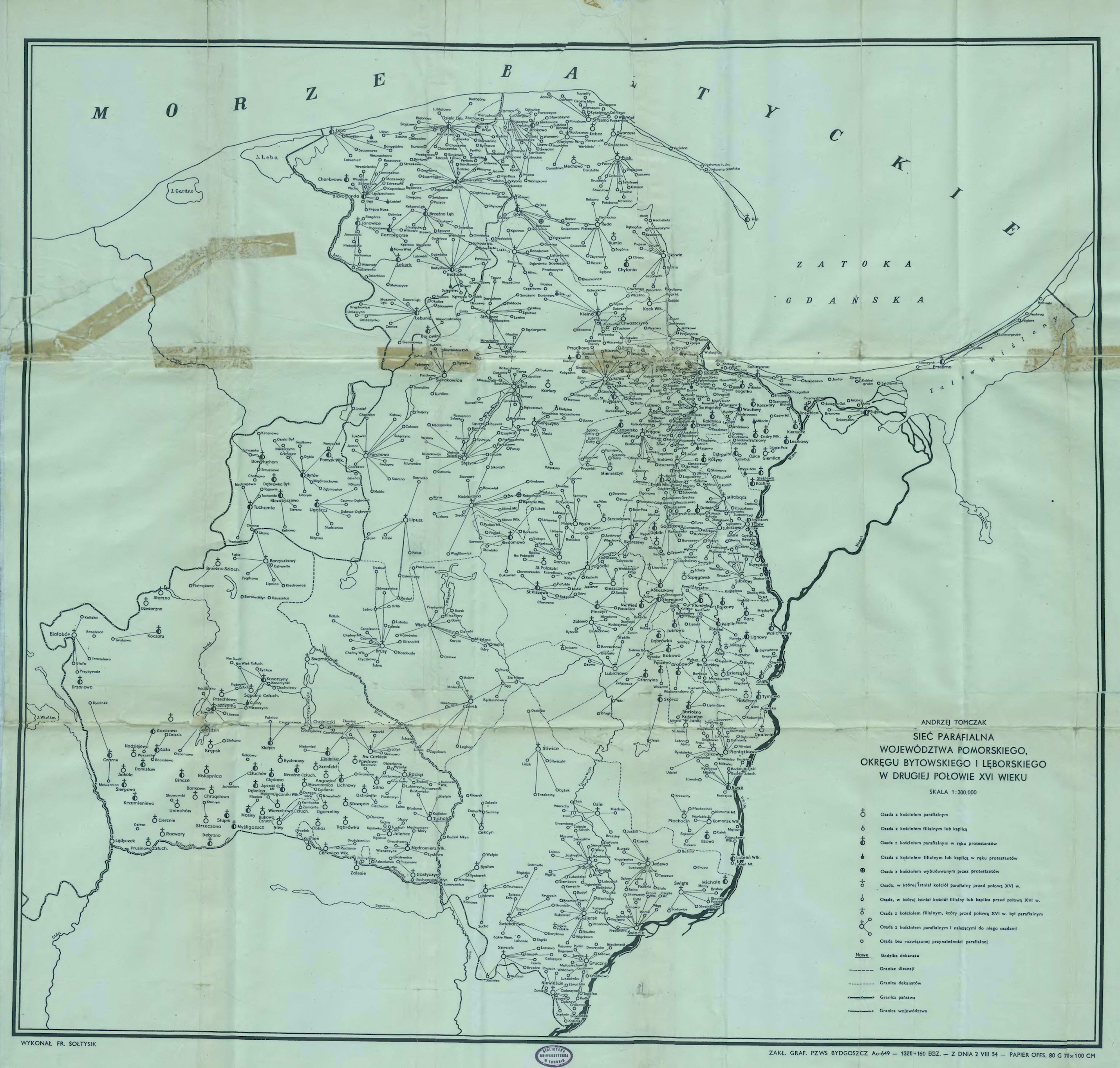
Kashubian Church Map
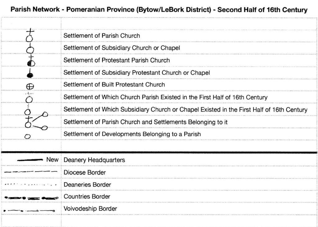
The rough translation of the map below is “Parish Network – Pomeranian Province (Bytow/LeBork District) – Second half of 16th Century.” I found online sometime in the last ten years but the site where it was found is no longer known and I don’t know who to credit it to. The key below the map has been replicated by hand to show the English translation of the details.
The map appears to show the primary churches that existed in the second half of the 1500s, the subsidiary churches that were part of the primary church network, and the settlements that belonged to the church. You can enlarge it to a degree, but it has a limit – you may need a magnifying tool to read it. Perhaps you can copy it to your computer and enlarge it there as I am able to enlarge the original copy on my computer.